
You are here: Start » AVL.NET » AVL.ImageWatersheds

AVL.ImageWatersheds
Computes dark basins which are separated by at least inThreshold height watershed.
| Namespace: | AvlNet |
|---|---|
| Assembly: | AVL.NET.dll |
Syntax
C++
C#
public static void ImageWatersheds
(
	AvlNet.Image inImage,
	int inThreshold,
	out AvlNet.Region[] outBasins
)
Parameters
| Name | Type | Range | Default | Description | |
|---|---|---|---|---|---|
 | inImage | AvlNet.Image | Input image. | ||
| inThreshold | int | <0, +INF> | 10 | Input minimum separating watershed height. Default value: 10. |
 | outBasins | AvlNet.Region[] | Output dark basins found. |
Description
Image is interpreted as a topographic map, where dark pixels represents valleys. Each step of iteration increase level of water in valleys, until basins are adjacent. Each basin is represented by another region in a result array.
Examples
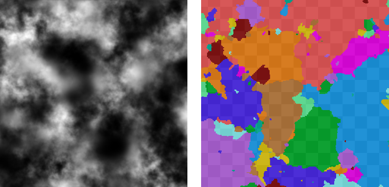
ImageWatersheds performed on the sample image.