
Back to Adaptive Vision Studio website


You are here: Start » Filter Reference » Image Segmentation » ImageWatersheds
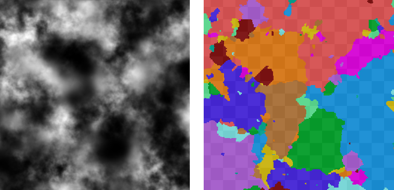
ImageWatersheds
Computes dark basins which are separated by at least inThreshold height watershed.
| Name | Type | Range | Description | |
|---|---|---|---|---|
 |
inImage | Image | Input image | |
|
inThreshold | Integer | 0 - + |
Input minimum separating watershed height |
 |
outBasins | RegionArray | Output dark basins found | |
Description
Image is interpreted as a topographic map, where dark pixels represents valleys. Each step of iteration increase level of water in valleys, until basins are adjacent. Each basin is represented by another region in a result array.
Examples
ImageWatersheds performed on the sample image.
Complexity Level
This filter is available on Advanced Complexity Level.
See Also
- SegmentImage_Gray – Segments an image into blobs examining differences between neighbouring pixels values.
- SegmentImage_Edges – Segments an image into blobs using image edges as their borders.